Namibia & Cross Border Rentals
Through Namibia to the Zambian border crossing
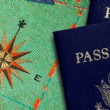
Early the next morning, I set off on the first leg of my trip through Southern Africa, travelling from Namibia to Zambia. After checking that my passport is in order (valid for more than six months and with at least two empty pages in the back) and the correct number of cross-border letters from Drive Africa's rental partner securely in my possession, I board my air-conditioned 4WD vehicle and take the B1 out of Windhoek. My destination for that night is Grootfontein, about 450 kilometres away. I am on the Namibian national road, a two-lane paved road that runs through hilly grassland.
Okahanja
After about 45 minutes I reach Okahanja, a small town, which was a Rhennish mission station in the late nineteenth century and is closely linked with the Herero people. I pass corrugated-iron buildings where locally produced woodwork is for sale but don't have time to stop.
Travelling along the national road in my 4x4, I notice the land is changing, becoming greener and more fertile. I am entering cattle country, Namibian-style, heading towards Ojiwarongo which the Herero named 'the Place of Fat Cows'. Cows graze contently behind the fences, except when they decide to take the high road home, in which case they have the right of way.
Otjiwarongo
I arrive in Otjiwarongo just a couple of hours after leaving Okahanja and head straight to the station to see the old steam engine (built in 1912 by the Henschel company in Germany). Travelling by train used to be my favourite mode of transport, until I converted to 4x4 adventuring!
After stopping at the garage to get my tyres and water checked, I am back on the B1 road. Eighty kilometres later, at Otavi, I turn onto the B8, direction Grootfontein. I could have stayed on the B1 and gone to the Ethosha National Park, one of the 'must-see' places in Namibia, but I decide to save that visit for the end of my trip. My priority is to complete my cross-frontier journey through Southern Africa - I will return to Namibia after travelling through Mozambique, Zambia, Zimbabwe, Swaziland, Lesotho, Botswana and South Africa.
Grootfontein and Hoba
Grootfontein means 'Big Spring' in Afrikaans and the town used to be a German military base. Das Alte Fort (the old fort) was built in the later nineteenth century and is now a museum. Being almost half way through today's leg of the journey, I decide to stop and visit the museum on top of a hill. Inside the museum is a complete smithy dating from the days of ox-cart travel. Am I pleased to be travelling in a comfortable 4x4 and not my ox-cart!
I head next to Hoba to see the largest meteorite in the world. I return to the B8 and turn off onto the D2885, which is quite good for a gravel road but I am still glad to be driving a 4WD vehicle. After another 2 km, I arrive at the national monument site.
Passing a sign that says 'Beware of the falling meteor', I find myself at what looks like a miniature amphitheatre, in the centre of which is a reddish brown lump of rock with shiny patches that look like stainless steel or chrome. The meteorite is smaller than I had expected although, according to the information board, it weighs approximately 50 tons and is thought to have fallen to earth less than 80 000 years ago.
I spend the night in a nearby campsite and the next morning I go into Grootfontein to shop and stock up the fridge. I check my water, oil and tyres and fill up with petrol, in preparation for the next stage of my journey, towards Rundu in the Caprivi Strip. The Caprivi is the only place in the world where the borders of four countries (Namibia, Botswana, Zambia and Zimbabwe) can be crossed within a few hours. I plan to cross the Namibian-Zambia border at the Wenela border post.
Rundu
The road to Rundu is long and straight. After about 100 km, the scenery changes and I start to feel like I am in undeveloped, 'real' Africa. Thatched rondavels cluster close to the road, fields of maize and millet interrupt the dense bush veldt. I have to slow down to avoid a herd of goats crossing the road (there are no fences).
Arriving at the campsite outside Rundu, I am tempted to stop. The location is spectacular, overlooking the Okavango River towards Angola. But it's still early so I decide to push on to the Popa Falls where the campsite is said to be even more scenic than the one at Rundu. I have been driving for over 200 km but am feeling relatively fresh, thanks to comfy seats, good suspension and air conditioning in my 4x4 rental vehicle.
Popa Falls
Two hundred kilometres on, I arrive at the Popa Falls - which I hear before I see - and find that that they are more like rapids than a waterfall: the river looks as if it's flowing down a flight of rocky steps. Just past a prison ground, I find the community run camping site. It is a gem! Even more scenic that the one at Rundu, next to the rapids and with individual camp areas. In minutes I have put up my roof top tent and am sitting looking across the Okavango River, enjoying a spectacular sunset and watching fish eagles dive for their dinner. As I listen to the hippos grumbling deeply to each other, I am glad to be up here in my bushcamper, safe from crocodiles and hippos.
The next day, I wake to the sound of the Okavango dawn chorus. Well rested, I set off along the Trans-Caprivi Highway (the B8) to Katima Mulilo, capital of the Caprivi. The speed limit is 80 km/hr and there are signs warning of elephants. But, I don't spot any elephants; all I see are dung piles and giant anthills.
Katima Mulilo / Wanella
Five hundred kilometres later, I arrive in Katima Mulilo, the capital of the Caprivi. Again, I camp on the banks of a river, this time the Zambezi. In the middle of the night, something wakes me up. I look outside and, in the moonlight, see a fantastic sight: a herd of elephants crossing the river, with only their trunks sticking out of the water. As they make their way alongside the campsite, I am again thankful to have a roof tent!
The next day, I fill up with petrol and supplies at one of the supermarkets in Katima Mulilo. Luckily my 4x4 has extra jerry cans and a 55 litre water tank because I am not sure how many petrol stations and shops there are in Zambia. Border formalities at the Wenela border post are quick and easy and I cross over into Zambia on a remarkable bridge, 900 metres long with 19 spans, built over the Zambezi.