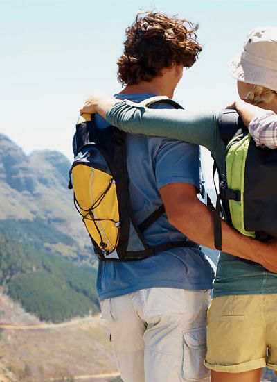
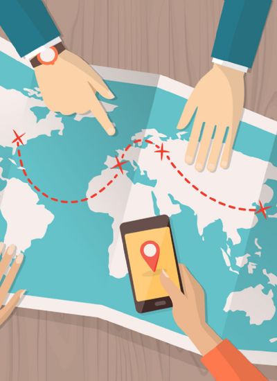
Introduction to backpacking and necessary GPS navigation equipment
In 1987 I moved to Phoenix from Milwaukee. I had always been physically active but other than an annual €change in color€ walkabout was not really a hiker. There is a local magazine here called Arizona Highways that always has the most beautiful wildflowers featured. I remember asking a friend where they could be found and I was told I needed to go into the desert to see them in their natural environment. And so began my hiking experiences. In the beginning using maps and routes provided by a local hiking website Hike Arizona.
One day I was running on the treadmill at the gym when I was approached by some one I knew very casually. He asked me if I had ever hiked the Grand Canyon. I remember looking at him and saying there is no way I am in Grand Canyon hiking shape. I had never been exposed to backpacking either. George went on to tell me that he had been planning annual trips for the past 20 years, he worked for a local law firm and there was a female who had expressed an interest in doing the hike but did not want to be the only female. He asked me to think about it. I approached the friend who had introduced me to hiking and asked him if he would like to do the hike he agreed to keep me company and join the group.
Backpacks were purchased, food and water provisioned for and the first etrex GPS unit was added to our carefully crafted list of needs. We provisioned in twos. I carried all our food, he carried our cook set. We did not duplicate anything George had picked the route we were doing the Boucher trail would be in for 2 nights. Five of us began this trip on May 1st at 5:40 am.
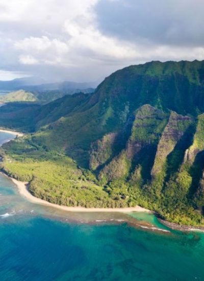
This Grand Canyon trail is not maintained, but still easy to follow. Our starting point was from Hermits Rest. The total distance from Hermits Rest to Boucher Rapids was 11.8 miles per our GPS unit and it took us 8 1/2 hours, not including our 2 hour siesta at Boucher Creek. This trail is pretty much a lateral transverse atop the red wall all the way around the Yuma Point. After Yuma Point, the trail heads back south into upper Travertine Canyon which is when it begins its first steep descent off of the red wall which is very similar to skiing a black diamond run. The switch backs are covered in loose scree from previous rock slides and the trail is very exposed in some sections.
I count that first trip into the canyon as life altering. The first night in camp we had access to a waterfall. On day two we discovered our first mistake. My friend and I had planned for 2 nights in (carefully weighed and measured provisions) and the rest of the group was planning on being in for 3 nights. We couldn't stay in even if we wanted to and so we had to split up the group.
Our GPS unit was invaluable in providing information on our location, the distance we needed to cover and later in providing us our trail in bread crumbs through way points. With the visual deceptiveness of the canyon's nooks and crannies and our inexperience, the etrex showed us how much elevation we had to cover and helped us to determine distance and set our pace needed to get out of there in the available daylight hours. I don't think I have ever been prouder of my accomplishments as realizing that the only way out was by the power of my legs and will in my heart. The discipline of rationing water and food because you couldn't run to the store for any more and yes the benefits of relying on technology.
We learned so much on that fist trip, how to plan it comfortably, how to be prepared, pacing and optimal daily mileage. Since then we have assembled a group of our personal friends and every July we do a backpacking trip. We have discovered the waterfalls of Yosemite, wandered knee deep in a water filled slot canyon and explored beautiful parks in Colorado and Washington. This core group of 7 has seen and shared some amazing stories and made unforgettable memories.
One day I was running on the treadmill at the gym when I was approached by some one I knew very casually. He asked me if I had ever hiked the Grand Canyon. I remember looking at him and saying there is no way I am in Grand Canyon hiking shape. I had never been exposed to backpacking either. George went on to tell me that he had been planning annual trips for the past 20 years, he worked for a local law firm and there was a female who had expressed an interest in doing the hike but did not want to be the only female. He asked me to think about it. I approached the friend who had introduced me to hiking and asked him if he would like to do the hike he agreed to keep me company and join the group.
Backpacks were purchased, food and water provisioned for and the first etrex GPS unit was added to our carefully crafted list of needs. We provisioned in twos. I carried all our food, he carried our cook set. We did not duplicate anything George had picked the route we were doing the Boucher trail would be in for 2 nights. Five of us began this trip on May 1st at 5:40 am.
This Grand Canyon trail is not maintained, but still easy to follow. Our starting point was from Hermits Rest. The total distance from Hermits Rest to Boucher Rapids was 11.8 miles per our GPS unit and it took us 8 1/2 hours, not including our 2 hour siesta at Boucher Creek. This trail is pretty much a lateral transverse atop the red wall all the way around the Yuma Point. After Yuma Point, the trail heads back south into upper Travertine Canyon which is when it begins its first steep descent off of the red wall which is very similar to skiing a black diamond run. The switch backs are covered in loose scree from previous rock slides and the trail is very exposed in some sections.
I count that first trip into the canyon as life altering. The first night in camp we had access to a waterfall. On day two we discovered our first mistake. My friend and I had planned for 2 nights in (carefully weighed and measured provisions) and the rest of the group was planning on being in for 3 nights. We couldn't stay in even if we wanted to and so we had to split up the group.
Our GPS unit was invaluable in providing information on our location, the distance we needed to cover and later in providing us our trail in bread crumbs through way points. With the visual deceptiveness of the canyon's nooks and crannies and our inexperience, the etrex showed us how much elevation we had to cover and helped us to determine distance and set our pace needed to get out of there in the available daylight hours. I don't think I have ever been prouder of my accomplishments as realizing that the only way out was by the power of my legs and will in my heart. The discipline of rationing water and food because you couldn't run to the store for any more and yes the benefits of relying on technology.
We learned so much on that fist trip, how to plan it comfortably, how to be prepared, pacing and optimal daily mileage. Since then we have assembled a group of our personal friends and every July we do a backpacking trip. We have discovered the waterfalls of Yosemite, wandered knee deep in a water filled slot canyon and explored beautiful parks in Colorado and Washington. This core group of 7 has seen and shared some amazing stories and made unforgettable memories.